How we're building the world's most accurate dataset on the carbon stored in forests

Forests have an important role to play in sustaining life on Earth, providing services ranging from biodiversity to socio-economic benefits, including being key to climate change mitigation. During photosynthesis, living trees draw carbon dioxide from the atmosphere and store it as carbon in their biomass. Approximately 50% of biomass is carbon.
Earth observation satellites collect large amounts of data on the world’s forests each day. However, there’s no spaceborne instrument that can directly measure forest above-ground biomass. Instead, these instruments measure how radiation scatters in, over and around forests.
To coax estimates of forest above-ground biomass out of such information, it is necessary to calibrate and validate the information using so-called “ground-truth” data. Conventionally, this is collected on-site in forests using tools such as tape measures and range finders, to measure parameters like stem diameter and tree height.
However, these methods can have large uncertainties associated with them, particularly in tropical and subtropical forests, owing to their significant diversity, in terms of both the structure and form of trees, as well as their taxonomy, the species of trees.
Using this state-of-the-art laser scanning technology, our global on-location forest research team collects data from the world’s forests, particularly tropical forests. This enables us to produce estimates of above-ground biomass with unprecedented accuracy, that are up to 15x more accurate than conventional methods.
We are able to use these datasets to better interpret satellite data using our advanced machine learning methods. In this way we can more accurately estimate the above-ground biomass and carbon stored in forests globally.
One outcome of this research is that it will help us improve the accuracy of our carbon score parameter, a key part of a Sylvera carbon credit rating. Our customers, such as corporate carbon credit buyers and carbon traders, are likely to invest more capital into forest projects we’ve rated highly, thus allowing more investment to flow into truly high-impact forest projects, which are forest projects that actually contain a high amount of carbon. In this way, our more accurate forest carbon dataset will help to avert the climate crisis.
Another interesting outcome is that these datasets, in corroboration with recent academic studies, suggest tropical forests may store more carbon than previously thought, and that global forest carbon stocks may therefore require a significant upward revision.
How our forest carbon storage project is set up
1. Data collection
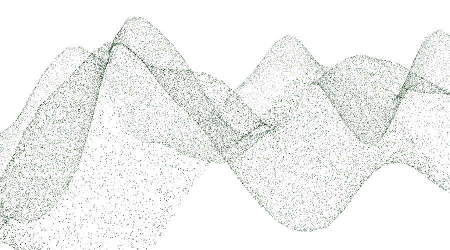
We visit forests around the world with our next-generation lidar, or laser scanning, instruments. We collect point cloud data on the ground using our terrestrial laser scanners — these millimeter-accurate data points comprehensively describe the structure of individual trees, right down to individual twigs and leaves. We also collect similar data from our airborne laser scanners mounted on unoccupied aerial vehicles (UAVs), which enables us to collect data over much larger areas.


2. Data processing
These novel datasets contain large amounts of information on forest structure and above-ground biomass, however, accessing this information is complex. We have therefore spent considerable time and effort developing the algorithms necessary to process these datasets. One example of this is the segmentation of individual trees. Pulling out data on individual trees, as shown in the illustrations below, enables us to carefully reconstruct and model tree-scale above-ground biomass.


3. Data integration
Finally, we train our state-of-the-art machine-learning models with these novel on-location laser scanning datasets. This enables us to routinely and robustly estimate forest-above ground biomass and carbon stocks from satellite data.

What our forest carbon storage project has achieved so far and what we’ll be doing next?
We have already successfully collected large amounts of data in the UK, Peru and Gabon, including scanning over one million tropical rainforest trees in Gabon and Peru using a drone.
This has already provided rich insights into the state and change of forest carbon stocks at these sites, which we will soon be reporting on and publishing. These datasets have also provided the perfect test set for developing and optimizing our processing algorithms.
Our aim over the next two years is to acquire and process these datasets from forests around the world. Our ambition is that our data will be representative of forests globally, allowing us to make accurate predictions on the world’s forests from satellite data, in near real-time.
About our forest carbon storage project team
Field Science
Our two field teams are led by Harriet Wilson and Dr. Beisit Luz. Both have extensive in-the-field experience, covering most continents. Harriet has an academic background in the fields of remote sensing and sensor development. Beisit has been managing and measuring forests in Peru for many years and holds a PhD in Management and an MSc in Ecology and Environmental Management. Tom Perry, one of our field scientists, adds knowledge of working in outdoor environments across the world as a guide, and holds an MSc in Geophysics. Annabel Locke, also a field scientist, has extensive experience working on the African continent, holds an MSc in Conservation Management and has experience working in biotech.
Research Operations
Operation of this ambitious global project is led by Ashleigh Parsons who has conducted and organized fieldwork across the world including, Africa, Asia and Europe. Ashleigh is supported by Elise Elmendorp who brings knowledge from an MSc in Environmental Resource Management.
Processing
Gabija Bernotaite, our research software engineer, brings a wealth of experience working with big data and 3D datasets in various capacities, including in the world of automated cars. As a true tech-nomad, Gabi manages our super-computer remotely from the sunny Canary islands.
Science
Dr Miro Demol, a lidar scientist, is based in Belgium and before starting at Sylvera, was based at the University of Ghent, as a researcher investigating the applications of laser scanning in forestry, with a particular interest in above-ground biomass estimation and its uncertainty.
Finally, the research team itself is headed by Dr Andrew Burt, a remote sensing scientist and tropical forest ecologist, who over the past 10 years, has helped to pioneer the use of laser scanning in forests.
Open positions: join the team
Our research team is hiring for several positions. If you have the relevant background and you’d like to join a leading research team doing cutting-edge work in forest and climate science, with the possible opportunity to travel, or work from just about anywhere, apply here.
Contributions were made to this article by all members of our forest carbon storage project team.
Learn how businesses are shaping carbon market strategies with carbon.

The end-to end carbon dataplatform for the 'net' in yournet zero goals


